Severe storms in North Texas left significant damage on Friday, with a confirmed tornado in Van Zandt County affecting homes and trees. In Grand Saline, over eight homes were damaged, although reports suggest that number could increase. Residents shared harrowing experiences; one homeowner described fleeing to a bathtub as winds ripped off the roof and interior walls. Another family reported their heavy porch being lifted and damaging their mobile home, forcing them to find temporary lodging. More storms are forecasted, bringing heavy rain and gusty winds. Next week promises a return to normal temperatures in the 70s and 80s.
DALLAS – On Friday, North Texas experienced significant storm damage.
The National Weather Service reported at least one tornado touched down in Van Zandt County.
Damage to houses and trees has been reported in the area.
Van Zandt County Damage from Storms
Storms Cause Widespread Damage in North Texas
On Friday, tornado-warned storms wreaked havoc in Van Zandt County. FOX 4’s Peyton Yager spoke to local families about their experiences and their temporary accommodations.
What we know:
Emergency calls started coming in around 3 p.m. in Grand Saline.
At least eight homes have been reported damaged in the city, though that figure may increase. Fortunately, no injuries have been confirmed.
Damage includes uprooted trees, downed power lines, and damaged homes.
Crews have already begun clearing fallen trees despite the rainy conditions.
What we don’t know:
Teams in Grand Saline are still assessing the extent of the damage.
What they’re saying:
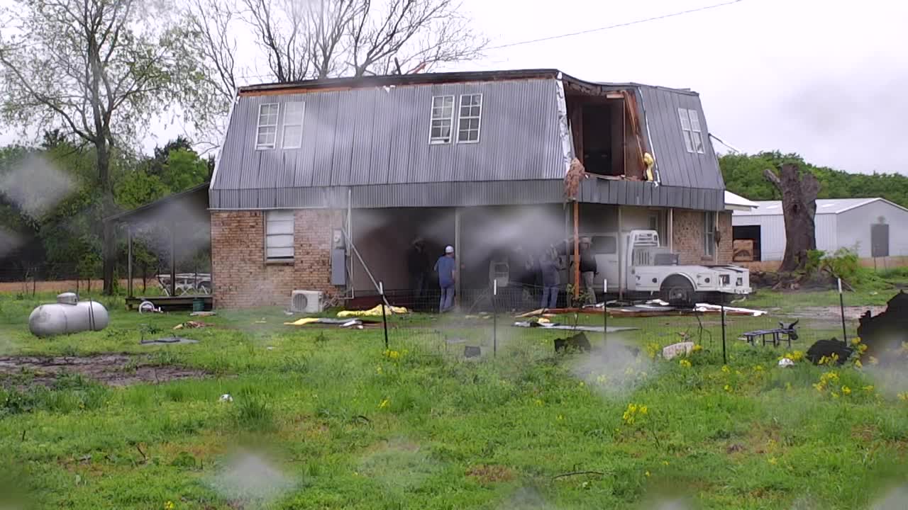
The front of a house on FM 1255 suffered damage.
Homeowner Kameron Martin described the frightening moment when he felt the house shaking due to the strong winds.
He took cover in the bathtub as the storms approached.
“I heard the roof pop off, followed by another loud sound. At first, I didn’t realize it was my bedroom wall coming off. I stayed in the bathroom for another five minutes before stepping out to assess the situation,” Martin recalled.
Once it was safe to emerge, Martin found that the second-story master bedroom was completely exposed, several trees had been uprooted, and the chain-link fence was destroyed.
Justina Goerdel reported that her 2,000-pound porch was lifted by the storm and lodged into the roof of her mobile home.
Currently, Goerdel, her husband, and their two children are staying at a nearby hotel for the weekend.
“It’s been emotionally overwhelming. We returned home to find the living room flooded. Water also entered my daughter’s room,” she shared. “I knew it would rain, but I never anticipated it would be this severe.”
Live Radar
Dallas Weather Forecast
Saturday forecast: Expect heavy rain, wind, and possible hail

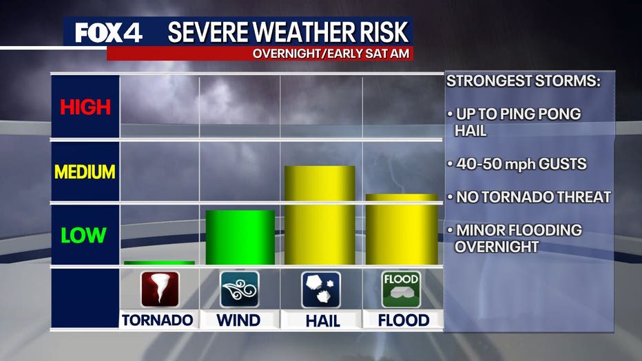
More storms are forecasted to move through overnight, leading to widespread rain, with some storms potentially bringing hail. While most hail will be on the smaller side, some could reach the size of ping pong balls. There’s no imminent tornado risk, but localized strong winds are expected.
An upper-level storm system is anticipated to arrive Saturday morning, which will bring heavy rain, wind gusts between 50 and 60 mph, and another chance for hail. Initially, temperatures will be in the upper 50s and will remain in that range throughout the day.
Rain chances will decrease by Saturday night, but clouds and gusty north winds are likely to linger. Evening temperatures will dip into the 40s, with light rain possible to the north and west of Dallas.
Sunday forecast: A chilly reminder of February
Sunday morning will be quite brisk, with temperatures in the 40s and wind chills reaching the 30s.
Although there may be a brief period of warmer conditions in the afternoon, high temperatures will remain in the 50s—approximately 20 degrees below the seasonal norm for April.
7-Day forecast

Rain is expected to clear up next week, with winds gradually calming.
Monday morning will bring the coldest temperatures, with lows in the upper 30s. However, high temperatures are expected to bounce back into the mid-60s.
By Tuesday, expect temperatures to return to normal levels, with highs reaching the 70s and 80s by midweek.
The extended forecast appears to remain dry for now.
The Source: This article’s information comes from the National Weather Service and meteorologist Evan Andrews.
